| |
G.F. Cruchley (publisher)
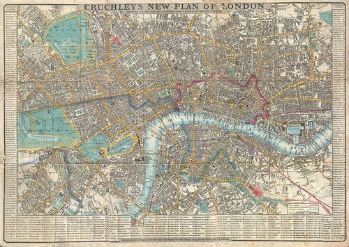
Cruchley's New Plan of London Shewing all the new and intended improvements to the Present Time
1848
Map
17 x 24 ins
Creative Commons - Wikipedia
Courtesy of Geographicus Fine Antique Maps
LL/46343
This is a very attractive example of G. F. Cruchley's highly desirable 1848 Map of London, England. Covers London from Hyde Park in the west to the London Docks in the east. Extends north to include all of Regents Park and south as far as the South Western Terimini and Vauxhill Gardens. Offers full and color and detail to the street level with individual buildings noted. Map surrounded on left, right and bottom by a street by street index of the city. Title area to center. Backed on linen and bounded into its original linen folder. Cruchley issued various editions of this map from 1827. This issue, 1848, is not in the Hogwego catalogue and is one of the rarest.
| |