| |
George Washington Colton (publisher)
Australia
1855
Map
13.5 x 16 ins
Creative Commons - Wikipedia
Courtesy of Geographicus Fine Antique Maps
LL/46334
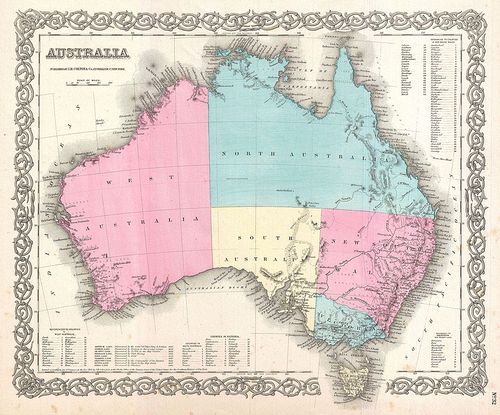
A beautiful 1855 first edition example of Colton's map of Australia. Covers the entire continent including Tasmania or Van Diemen's Land. Colton's mappings of Australia, updated annually through the 1860s, offer a comprehensive overview of the mapping and exploration of the continent's interior. This map notes Stuart's Farthest Point, a few rivers, and little else in the vast and desolate continental interior. Where known, Colton identifies various cities, towns, forts, rivers, desert oases, and an assortment of additional topographical details. Surrounded by Colton's typical spiral motif border. Dated and copyrighted to J. H. Colton, 1855. Published from Colton's 172 William Street Office in New York City. Issued as page no. 32 in volume 2 of the first edition of George Washington Colton's 1855 Atlas of the World .
| |