| |
A. Vuillemin (prepared by)
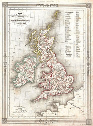
The British Isles (England, Ireland, Scotland)
1851
Map
12.5 x 9.5 ins
Creative Commons - Wikipedia
Courtesy of Geographicus Fine Antique Maps
LL/46331
An uncommon and attractive 1852 map of the British Isles by A. Vuillemin. Details England, Scotland and Ireland as well as parts of neighboring France. Based on an earlier map by the English mapmaker Wild. Upper right corner features a list of counties which are numerically coded into the map. Features a beautiful frame style border. Prepared by A. Vuillemin for publication as plate no. 9 in Maison Bassets 1852 edition of the Atlas Illustre
| |